
Oxford Township ZIP Code Coverage
Only two postal facts are confirmed for this Oxford Township ZIP code directory: Township contacts use 45056, and a College Corner post office uses 45003. Those facts do not draw a complete postal boundary around the civil Township. USPS delivery areas serve mail, while the Township, City of Oxford, College Corner, parcels, school districts, and service areas answer different geographic questions. Validate an individual address with USPS before using either number as part of a record search.
| ZIP | Areas Covered | Post Office | Notes |
|---|---|---|---|
| 45056 | Confirmed postal identity for Oxford Township contacts; Oxford also uses this postal identity | Oxford Post Office, 5145 Brown Rd., Oxford, OH 45056-9998 | Confirm every address with USPS. This is not a Township boundary map. |
| 45003 | College Corner postal facility; the census identifies a College Corner part within Oxford Township | College Corner Post Office, 18 Liberty Ave., College Corner, OH 45003-9998 | The available source does not map its delivery area across the Township. |
The table intentionally stops short of declaring either number a complete geographic coverage area. No official USPS or County map captured in the research identifies every ZIP that intersects the full Township. A postal facility nearby is not proof that its ZIP serves a particular parcel, and a City-style mailing address does not settle City jurisdiction.
Exact Oxford Township USPS ZIP Checks
USPS ZIP Lookup is the proper first check for a mailing or situs address. Enter the exact street address and retain the standardized result instead of relying on a place-name label. That result can settle the postal presentation of one address. It cannot establish a Township line, an annexation boundary, a parcel line, or a complete list of people associated with the ZIP. The Oxford Township ZIP code directory therefore uses USPS as a validation step before County property research begins.
Visit USPS ZIP Code Lookup to validate the exact address.
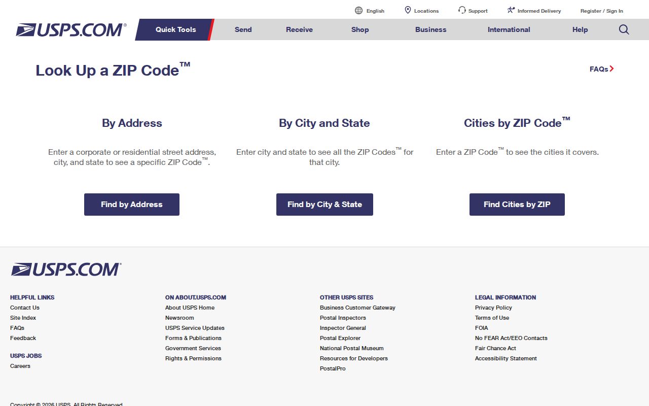
The lookup is useful because it tests the address actually supplied. A postal result should then be carried to the Auditor as an address, not treated as a ZIP-wide property or current-residence search.
45056 Oxford Township Postal Anchor
Oxford Township’s official contact identity uses 45056, including its mailing and police-contact addresses. USPS identifies the Oxford Post Office at 5145 Brown Rd., Oxford, OH 45056-9998. This is strong evidence for the Township’s own postal identity and a sound reason to begin address validation there. It still does not turn 45056 into the legal boundary of Oxford Township or the City of Oxford. Use an exact USPS result and an authoritative boundary source for each property question.
The USPS Oxford Post Office location page supplied the postal-facility detail captured here.
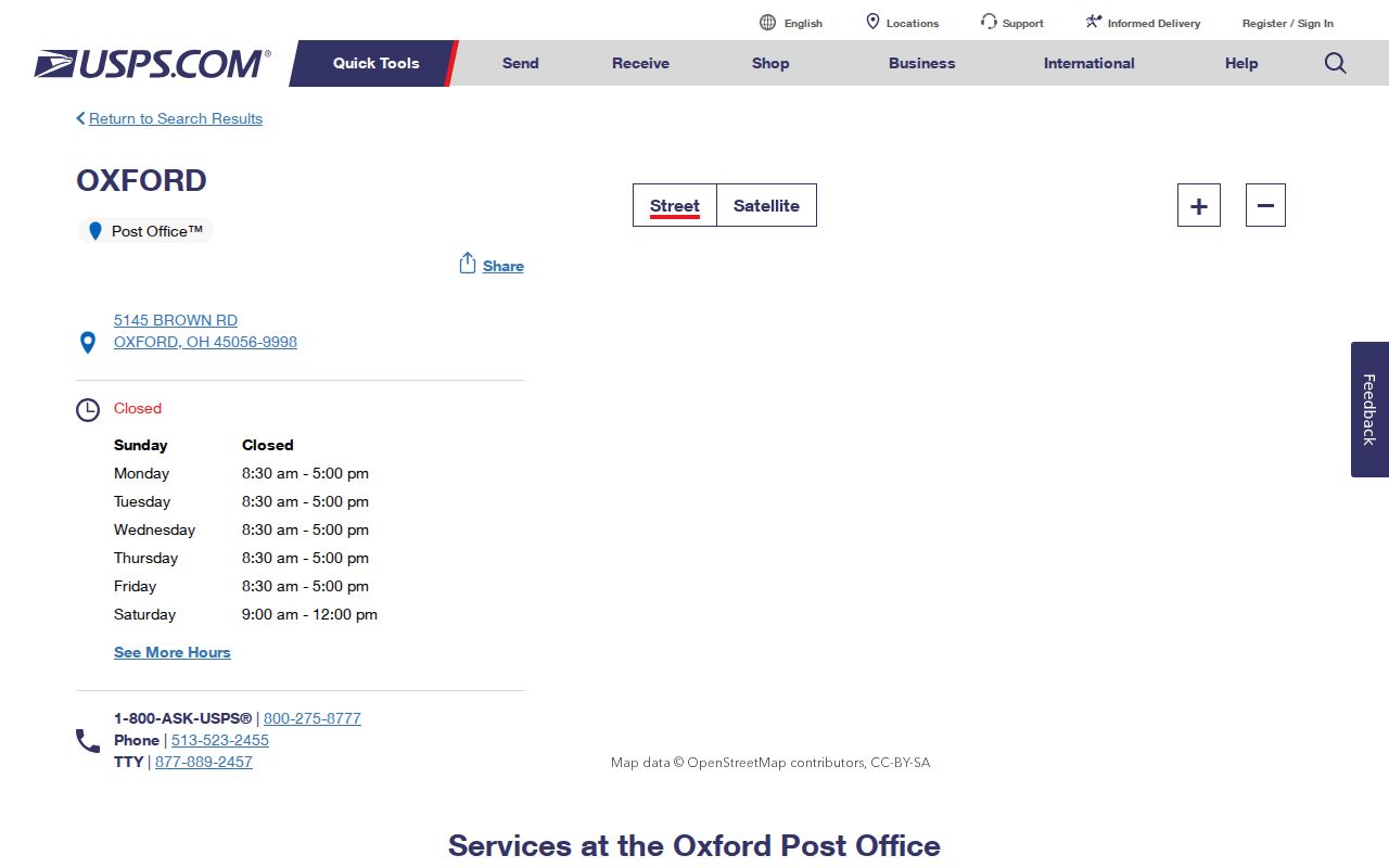
The facility listing confirms the post office’s mailing identity. It is not an address-by-address delivery map or a government-jurisdiction lookup.
45003 Oxford Township Postal Limits
College Corner is part of the Township’s records geography because the official census table identifies a College Corner village part within Oxford Township. USPS separately identifies the College Corner Post Office at 18 Liberty Ave., College Corner, OH 45003-9998. The available facts establish the facility and the census relationship. They do not show where the 45003 delivery area begins or ends within the civil Township. Treat 45003 as an exact-address USPS validation possibility, not a declared Township-wide coverage claim.
The assigned USPS location result is a postal-facility screen, not a civil-boundary source.
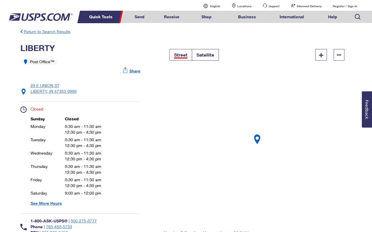
A location result can confirm a facility detail for the individual result shown. It cannot substitute for an exact address lookup when deciding whether a Township parcel uses a given ZIP.
Oxford Township Civil Geography
Oxford Township is not a single municipal records route. The official 2020 table separates Oxford city, a College Corner part, and the unincorporated Township remainder. That is why City records should not be applied to a Township address simply because the mailing city is Oxford. First determine the parcel’s jurisdiction from County and authoritative City sources. Then use the custodian that actually maintains the requested map, permit, parcel, or recorded document.
This boundary check is especially important for a ZIP code directory search. Postal geography can span or stop short of a civil boundary, while local records are usually held by the County or the government whose territory and program produced the record. The postal label narrows the question. It does not replace the jurisdiction check.
Oxford Township ZIP Code Parcel Workflow
Once USPS validates the address, use the County systems in an order that preserves their different roles. The Butler County Auditor Address Search accepts street number and street name, and its instructions say not to enter a suffix. It has no published ZIP filter. A blank number plus a street can broaden the parcel browse, but the resulting list is property data, not a roster. From the address result, retain the parcel ID, situs, separate mailing fields, legal description, and source date.
- Validate the precise address and ZIP with USPS, then save its standardized presentation.
- Search the Butler County Auditor by street number and street name, without a suffix, to find the parcel record.
- Compare the parcel’s situs, mailing fields, parcel ID, and legal description. Establish whether it is in City territory or the unincorporated Township.
- For a City property, use the City address, annexation, permit, or zoning route after that jurisdiction check. For County land and title research, use the Auditor map and Recorder party, legal, or OCR fields.
- For older address evidence, request a dated reverse or criss-cross directory from Lane Libraries and compare it with deeds, census material, and local newspapers.
For the address-level part of that sequence, use the Oxford Township Street Directory. A ZIP helps standardize the starting address, while the parcel and legal description do the work of connecting official land records.
No Oxford Township ZIP-Only Search
No documented Butler County or local portal in the research supplies a ZIP-only resident or property search for Oxford Township. The Auditor’s address mode has no published ZIP filter. Treasurer search accepts parcel ID, name, or address. Recorder OCR can find an address or parcel only when that text occurs in a recorded document. Ohio’s name-and-county voter lookup is also person oriented, not a ZIP browse. The correct route is exact address, then parcel and jurisdiction, rather than a sweeping ZIP query.
The Ohio Department of Rehabilitation and Correction Offender Search shown below has ZIP filters, but it is not a directory or a current-residence record. It should not be used to infer who lives at an Oxford Township address or to build a postal-area roster.
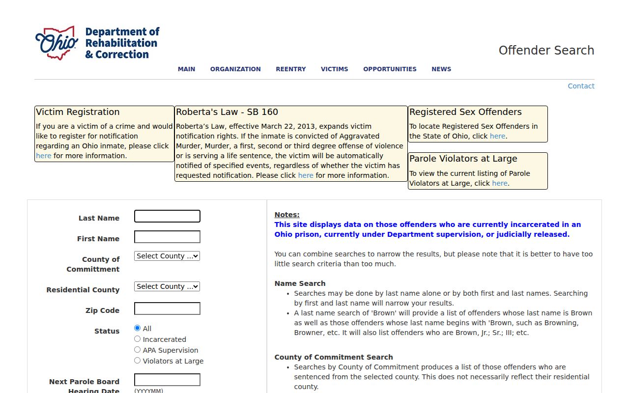
The available filter illustrates a narrow program-specific search field. It does not change the absence of a verified ZIP-only County property or resident directory.
Oxford Township City Jurisdiction
For an address actually in the City of Oxford, City GIS can provide address, street-centerline, planning, zoning, and annexation context. The City launched GovWell for building permits on May 1, 2026, and its reports can provide City address, permit number, permit type, and issue-date evidence. The County Auditor and Recorder remain the countywide property and recorded-land route. A City portal result should be used only after the address has passed the jurisdiction check.
The assigned Butler County address-based polling locator also shows why an address matters more than a ZIP alone for local services.
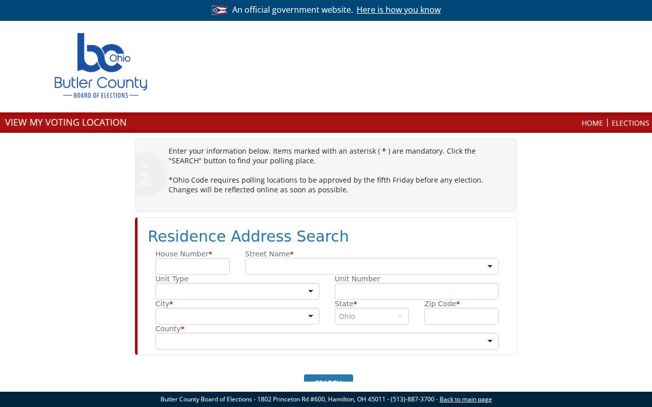
The locator requires an address to return a polling location. It is not a postal boundary map or a substitute for City and County jurisdiction records.
Oxford Township Historical Address Layer
Postal ZIPs are not a reliable historic-directory key. When an older address is the question, retain the street description, parcel, legal description, and dated place clues instead. The Recorder’s advanced search exposes City, Subdivision, Township, and Condo legal fields because a modern street address cannot safely translate every earlier record. Some deeds from the 1930s and 1940s may be indexed by book and page rather than a normal address or party index, so old research may require the legal description and a Recorder counter follow-up.
Lane’s catalog establishes a Hamilton-Oxford Dickman criss-cross series, but exact annual holdings and access conditions remain unverified. Ask for the actual volume closest to the target date, preserve the published address notation, and compare it with deed, census, newspaper, or probate evidence. A dated printed listing can add context to a property trail; it does not substitute for the official parcel or recorded instrument.
Oxford Township ZIP Code Terms
Postal and land-record terms need to stay separate. The ZIP code directory is most useful when its definitions are paired with the exact address and the property record, rather than used to draw unsupported lines around the Township.
- ZIP and ZIP+4
- A ZIP identifies a postal delivery area. A ZIP+4 adds a more specific delivery segment to the base ZIP; neither one establishes municipal jurisdiction or parcel ownership.
- PO-box ZIP
- A ZIP used for post-office-box delivery. It should not be assumed to describe physical delivery addresses or the area around a post office.
- Unique ZIP
- A postal code assigned for a single high-volume recipient or institution. No such Oxford Township assignment was confirmed in the research.
- Carrier route
- A delivery route used for mail handling. It is not a legal boundary, a parcel boundary, or a current-residence directory.